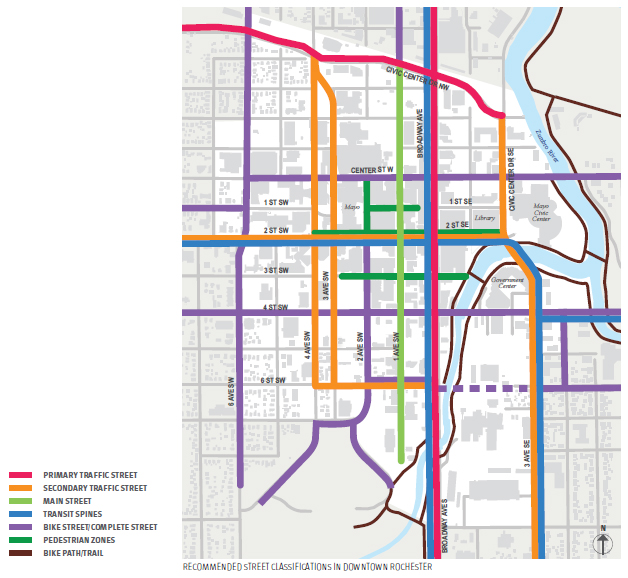
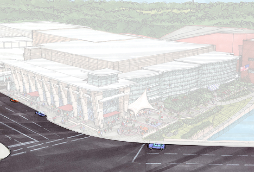
Design Rochester was asked to host a design charette focusing on creating a safer, more balanced, and more pedestrian-friendly place at the terminus of 2nd Street in front of the newly expanded Civic Center. Due to the Mayo Civic Center expansion construction project these past ten months, the traffic lanes along Civic Center Drive SE have been reduced down to as little as one lane in each direction. While the construction has made accessibility difficult, there have not been any detrimental effects of the temporary road diet. Traffic flows smoothly, albeit slower, and there have been no more pedestrian fatalities than compared to previous years. Councilman Wojcik and others have advocated for a more thoughtful design of this thoroughfare before simply reverting back to the previous design once construction is complete. Furthermore, the Rochester Downtown Master Plan (RDMP) and Destination Medical Center (DMC) Development Plan highlight improvements to the public realm at this crucial hub.
There appears to be no design for the street in front of the Mayo Civic Center expansion
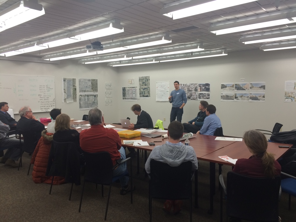
Because the properties, businesses, and streets surrounding this terminus have an impact on the overall usefulness, every attempt should be made to include those constituents and stakeholders in how changes can serve and compliment this high profile intersection. Only after a vision is crafted, can the implementation be championed by stakeholders and reviewed by city staff in a more holistic manner.
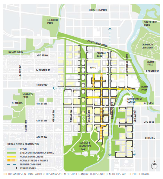
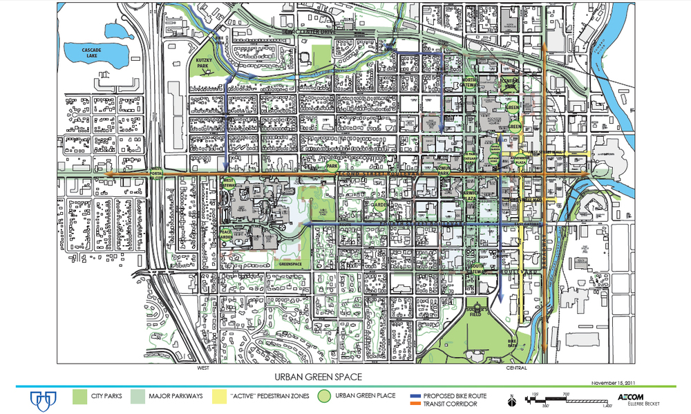
The conversation around the design of our streets is changing. The predominant view that streets are the exclusive domain of the automobile has been called into question. New examples and case studies of transforming streets back into places for the public are proliferating. This is an attempt to begin to create a vision for a place in downtown Rochester--to build consensus for change. As such, this project should be designed in concert with a greater vision for the downtown urban fabric, and should incorporate the long term objectives of the RDMP and DMC plan.
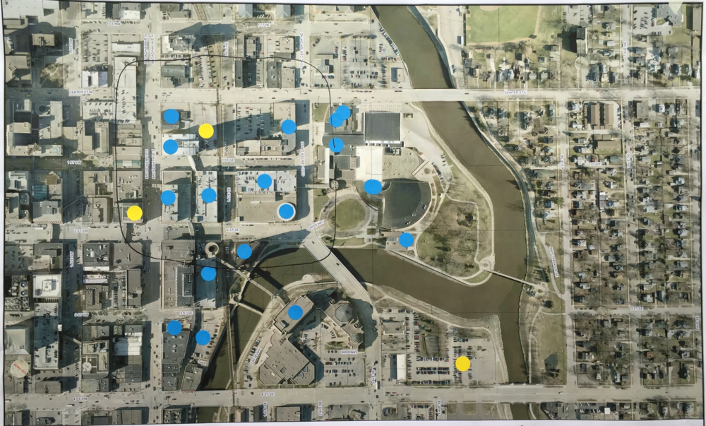
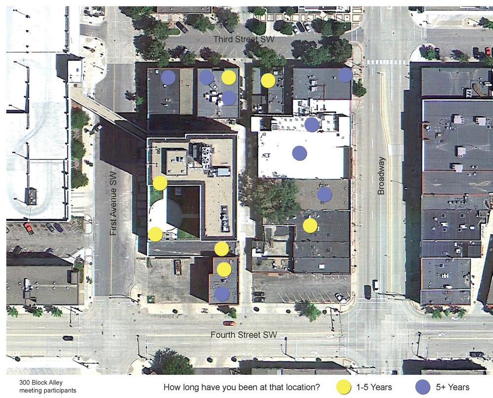
Meeting participants indicating what locations they represent (blue and yellow dots)
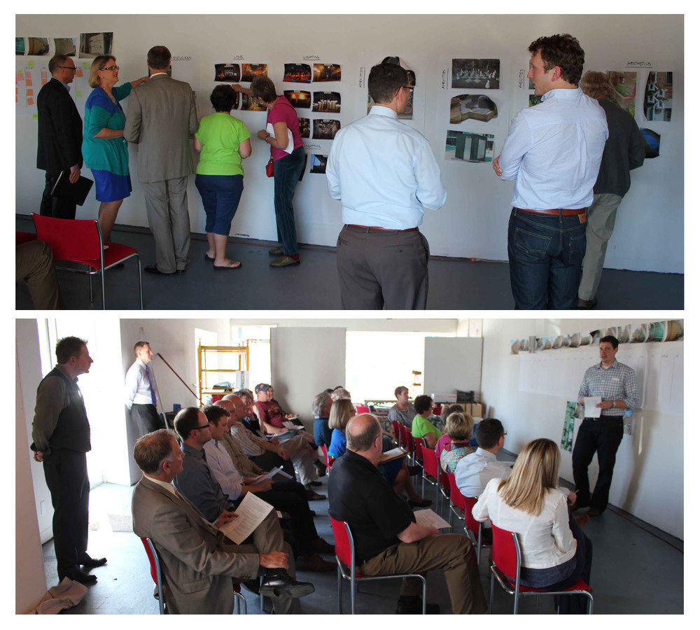
The participants in the charette were from the City of Rochester, Rochester Public Library, Mayo Civic Center, Rochester Civic Theatre, Rochester Art Center, Post-Bulletin, and many more who had an interest in the overall intentional design for this area.
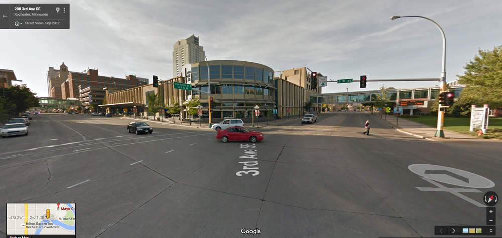
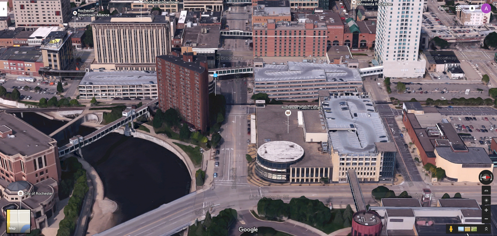
Existing Intersection of 2nd Street SE and Civic Center Drive SE (prior to construction)
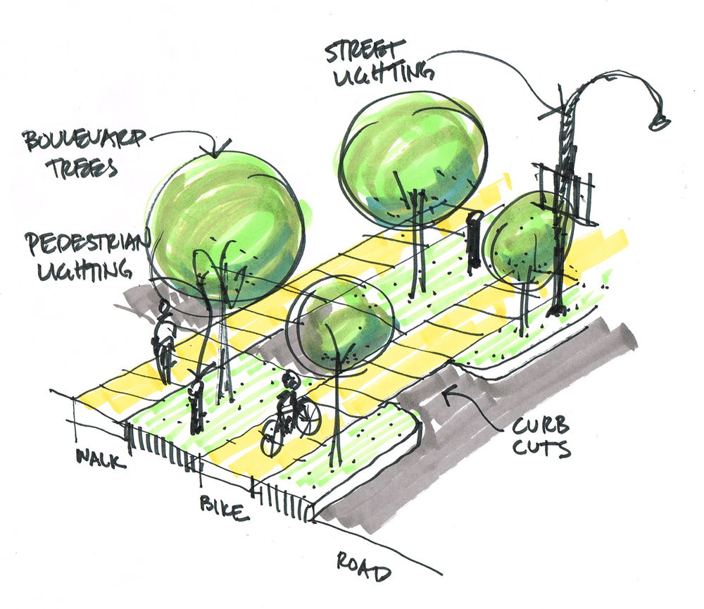
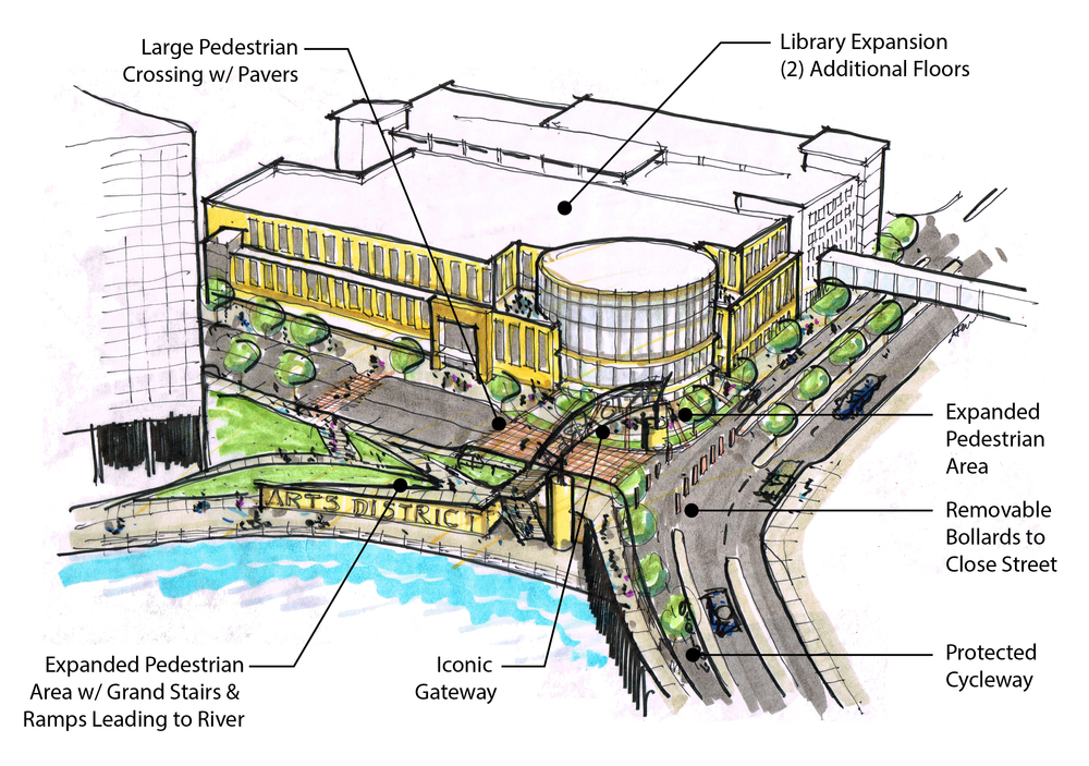
ELEMENTS OF THE VISION

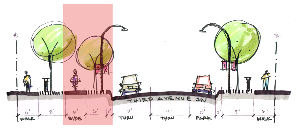
Adopting "road diet" recommendation from RDMP and DMC Plan for 2nd Street SE
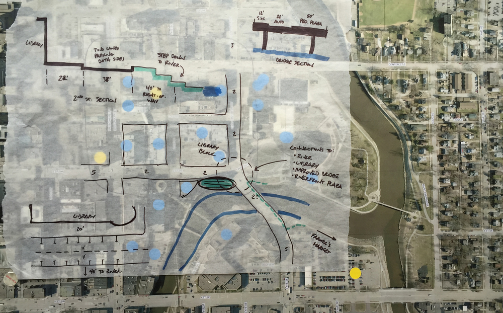
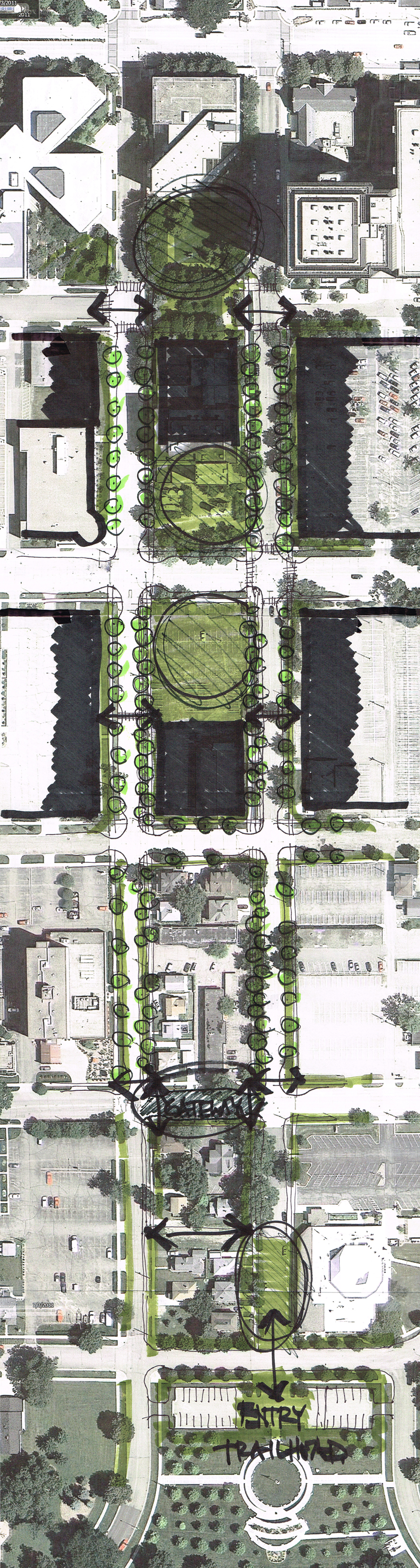
Proposed changes to the bridge across the Zumbro River (narrower, more pedestrian space)
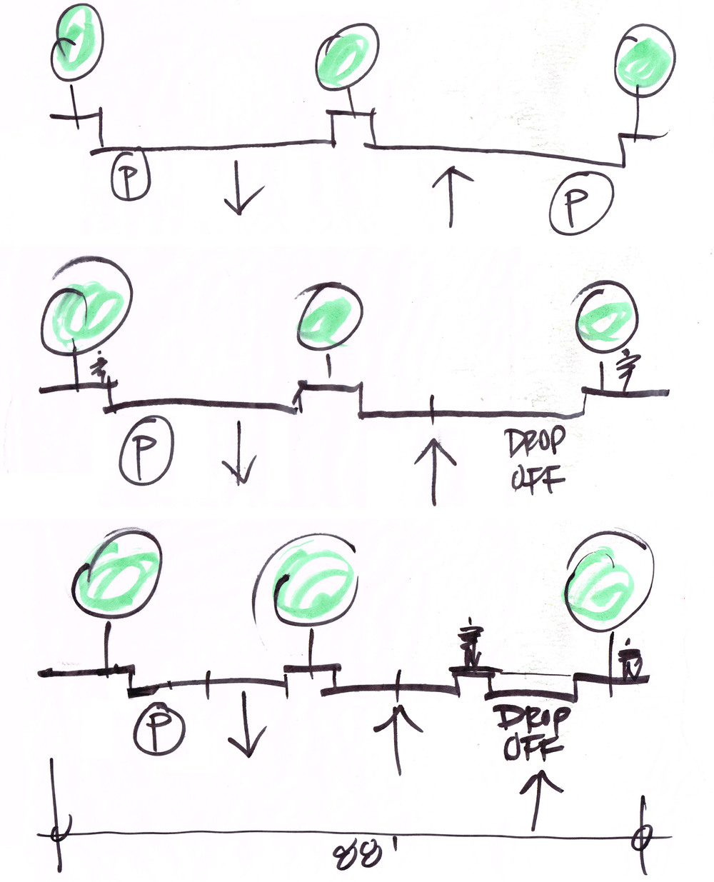
Civic Center Drive R-O-W options
The entire 2nd Street Terminus vision report can be downloaded HERE .